Cartographer's Crisis Board Visualization
A complex, multi-section text prompt for generating a detailed, documentary-style visualization of a historical or fictional event (conflict, expedition, or migration) using a cartographer's crisis board aesthetic. It requires a visual transition from calm topography to urgent wartime graphics and melancholic aftermath, suitable for use with Nano Banana Pro and Adobe Firefly.

Generated result using this prompt
The Prompt
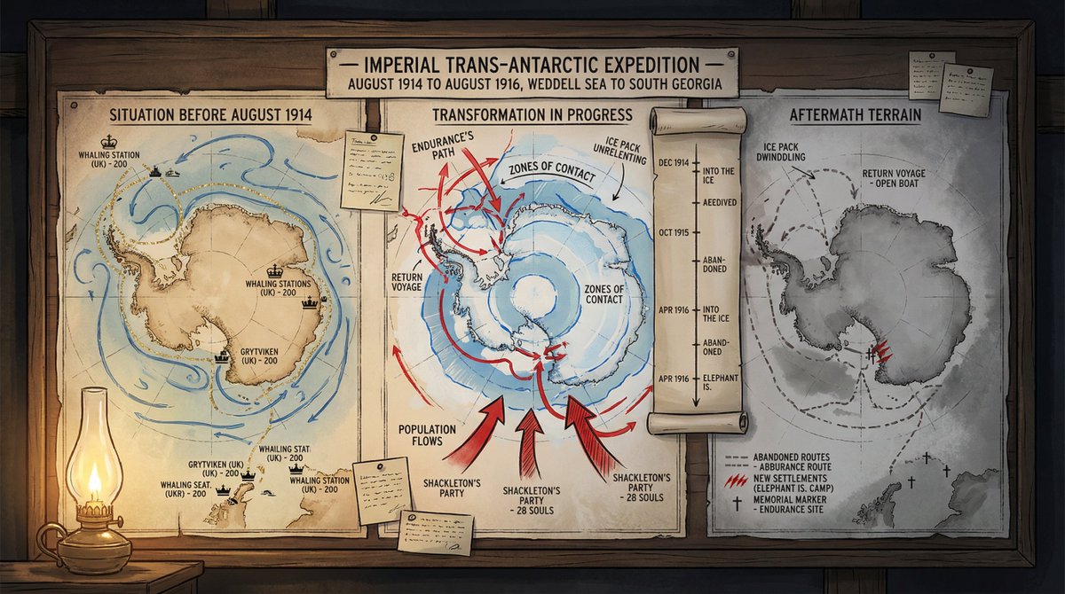
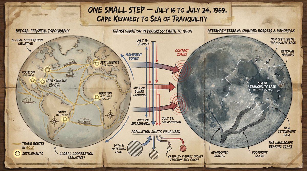
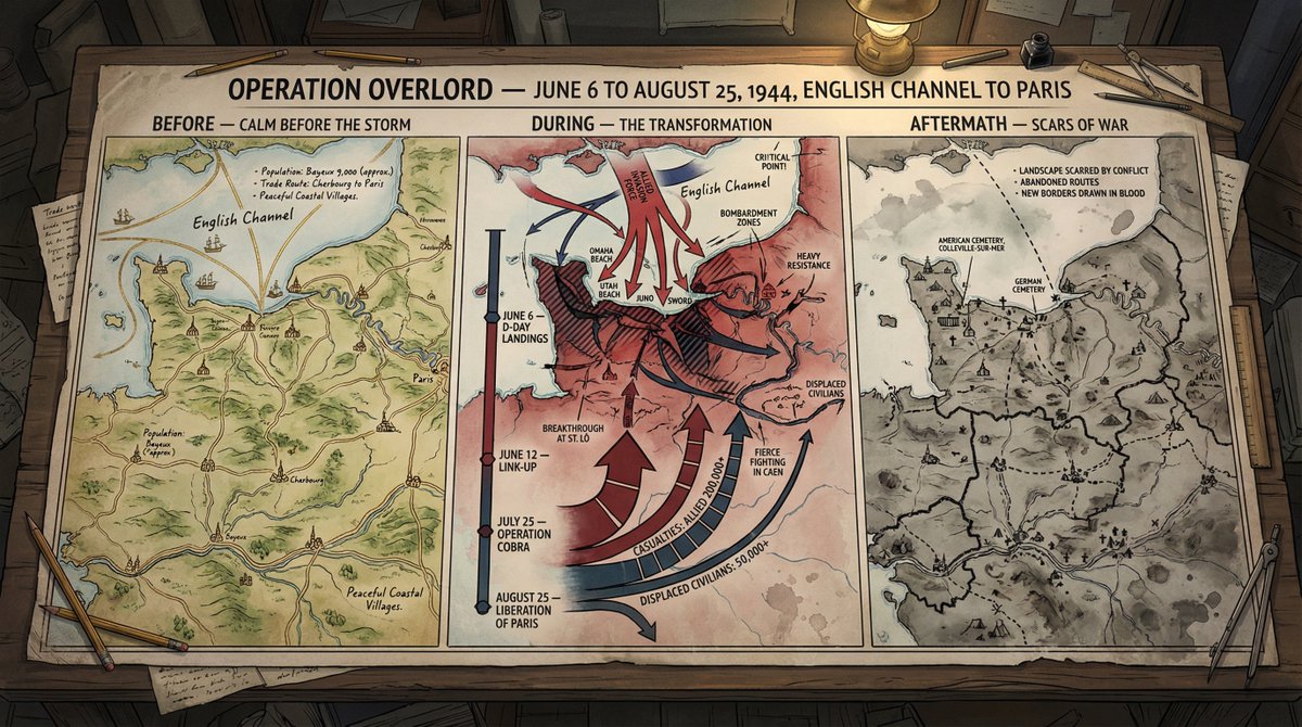
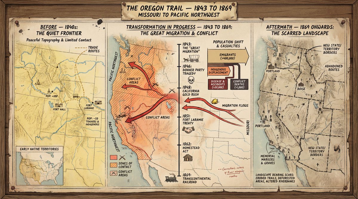
A cartographer's crisis board mapping {argument name="event type" default="CONFLICT"} — {argument name="time and place" default="ERA / REGION"}. Left section: the situation before—peaceful topography, trade routes in gold, settlements marked with period-appropriate symbols, populations annotated. Center section: the transformation in progress—arrows of movement, zones of contact marked in graduated intensity, timeline running vertically with key dates as waypoints, casualty figures or population shifts visualized as proportional flows. Right section: the aftermath terrain—changed borders, abandoned routes, new settlements, memorial markers, the landscape bearing scars of what passed through it. Visual style transitions from pastoral survey calm through urgent wartime graphics to melancholic documentary. Hand-lettered annotations throughout. Title block reading "{argument name="event name" default="EVENT NAME"} — [START DATE] TO [END DATE], [GEOGRAPHIC SCOPE]".
About This Prompt
A complex, multi-section text prompt for generating a detailed, documentary-style visualization of a historical or fictional event (conflict, expedition, or migration) using a cartographer’s crisis board aesthetic. It requires a visual transition from calm topography to urgent wartime graphics and melancholic aftermath, suitable for use with Nano Banana Pro and Adobe Firefly.
Prompt Details
ID: 9339
Requires Reference Images: No
Sample Images
Full Prompt
A cartographer's crisis board mapping {argument name="event type" default="CONFLICT"} — {argument name="time and place" default="ERA / REGION"}. Left section: the situation before—peaceful topography, trade routes in gold, settlements marked with period-appropriate symbols, populations annotated. Center section: the transformation in progress—arrows of movement, zones of contact marked in graduated intensity, timeline running vertically with key dates as waypoints, casualty figures or population shifts visualized as proportional flows. Right section: the aftermath terrain—changed borders, abandoned routes, new settlements, memorial markers, the landscape bearing scars of what passed through it. Visual style transitions from pastoral survey calm through urgent wartime graphics to melancholic documentary. Hand-lettered annotations throughout. Title block reading "{argument name="event name" default="EVENT NAME"} — [START DATE] TO [END DATE], [GEOGRAPHIC SCOPE]".
Share This Prompt
Prompt Info
Tags
Daily Prompt Updates
New prompts are automatically curated daily from top AI creators on X.