Image Generation Nano Banana Nano Banana Infographic Educational
Cartoon drone-style Google Maps aerial illustration prompt
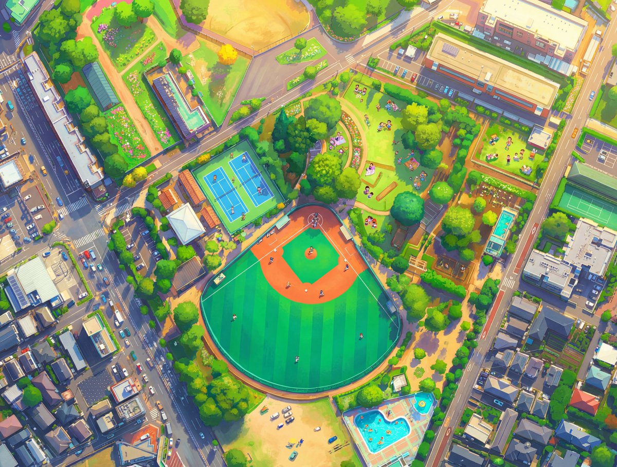
A prompt that converts Google Maps or Google Earth aerial screenshots into vibrant, whimsical cartoon-style drone photographs with tiny figures and magazine-quality illustration.

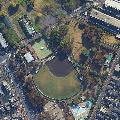
Generated result using this prompt
The Prompt
Transform this aerial map view into an illustrated aerial photograph captured from above. Create a vibrant, animated aesthetic with brilliant colors and scatter miniature figures throughout the scene for a whimsical, magazine-quality illustrated result.
About This Prompt
A prompt that converts Google Maps or Google Earth aerial screenshots into vibrant, whimsical cartoon-style drone photographs with tiny figures and magazine-quality illustration.
Prompt Details
ID: 780
Requires Reference Images: Yes
Sample Images
Full Prompt
Transform this aerial map view into an illustrated aerial photograph captured from above. Create a vibrant, animated aesthetic with brilliant colors and scatter miniature figures throughout the scene for a whimsical, magazine-quality illustrated result.
Share This Prompt
Prompt Info
Tags
Nano Banana Infographic Educational Visual
Daily Prompt Updates
New prompts are automatically curated daily from top AI creators on X.
Auto-curated from X